
The hike provided us with incredibly beautiful and varied views. From about halfway up the mountain, the greenery was stunning.

Looking back down the mountain toward where the previous photo was taken, we could see the crystal blue of the Walchensee, one of the numerous lakes we spotted along our hike.

From even higher we could see more of the Walchensee as well as part of the trail that brought us to the peak.

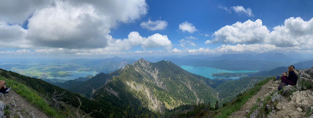
Our hike entailed three legs. The initial leg was the climb to the first peak, Herzogstand (1731m). The middle was the ridge trail between the Herzogstand and Heimgarten (1791m), the second peak we climbed. This picture shows the ridge trail between the two. The third and final leg was our descent from the Heimgarten to the town of Ohlstadt.

When looking north, we could see the Riegsee, to the east, and the Staffelsee, to the west, as well numerous small towns that line the way back to Munich.

Peaking through the rocky ridge is the Kochelsee and the village from which we departed for our hike.

We snapped this picture from the second peak we climbed, Heimgarten. The peak to the left is the Herzogstand, the first peak we reached, and the Walchensee is off to the right. To the left you can see the ridge trail we took between the two peaks.
")
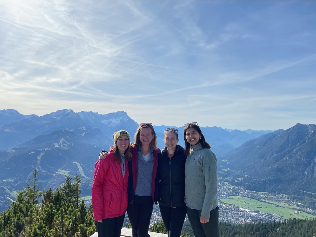
Here are a bunch of happy hikers at the Heimgarten peak!
On Sunday some floormates and I took on a demanding but wonderful hike through the Alps from the small southern Bavarian town of Kochel am See to the neighboring town of Ohlstadt. This link provides an interesting overview of our hike.

Leave A Comment